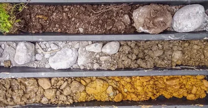
We opened a test pit last week behind a job site off Higley Road where the contractor was certain he'd hit caliche at four feet. He didn't. We dropped the bucket seven feet through silty sand and found a buried trash layer from the 1980s that nobody knew about. That's Gilbert for you: old agricultural parcels, rapid infill, and subsurface surprises that don't show up on a grading plan. A test pit is our first tool when a client needs a direct look at the soil profile before foundation design. It exposes the stratigraphy in plain view so we can identify loose zones, old fill, and perched water. In a town that's added over 200,000 residents since 1990, you'd be surprised how many plots carry undocumented debris from the days when this was alfalfa fields and citrus groves. We run our exploratory program under IBC Chapter 18 and standard ASTM D2487 logging methods, and our lab holds ISO 17025 accreditation for classification work.
You can read a dozen boring logs and still miss what one open pit wall shows you in five minutes.