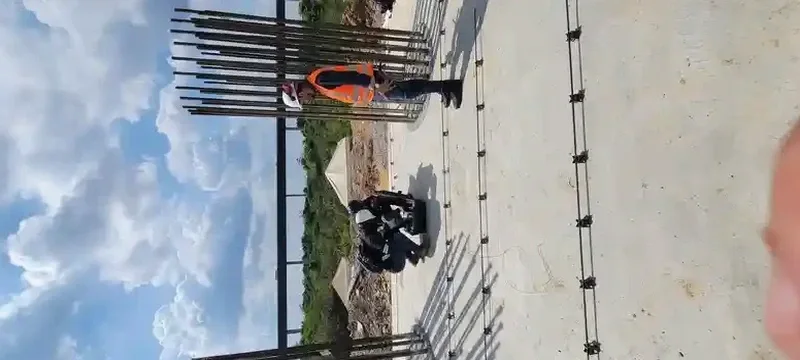
The geophone array stretches across the graded pad, a line of 24 vertical-component receivers spaced to capture surface wave dispersion across a broad frequency spectrum. In Gilbert’s eastern valley terrain, where the transition from basin fill to harder sedimentary rock can be subtle, that array configuration matters. Our field crew deploys a sledgehammer source and sometimes a weight drop, recording the propagation of Rayleigh waves through the subsurface to depths of 30 meters or more. The raw time-domain records are transformed through multi-channel analysis into a dispersion curve, which we then invert to obtain a one-dimensional shear wave velocity profile. This is the core of the MASW method, and from that profile we calculate VS30, the time-averaged shear wave velocity to 30 meters depth that directly determines the IBC seismic site class for the project.
VS30 is not just a number for the structural engineer—it’s the parameter that defines the seismic design category and the lateral force demands on the building.