GEOTECHNICALENGINEERING
GILBERT
HomeGeophysicsSeismic tomography (refraction/reflection)

Seismic Tomography (Refraction/Reflection) Surveys in Gilbert

Geotechnical engineering with regional judgment.

LEARN MORE

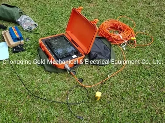
The dry washes and deep basin fill across Gilbert create a tough contrast problem for conventional geotechnical drilling. In the Heritage District and out toward the Santan Mountains, we often find coarse alluvium and caliche layers that make SPT refusal common above 30 feet. That’s where seismic tomography earns its place on the exploration program. By recording P-wave and S-wave arrivals across a spread of 24 or 48 geophones, we build a velocity model that shows the transition from stiff alluvium to cemented conglomerate and finally to crystalline basement. For projects that need continuous stiffness profiles without pushing through cemented gravel, we pair the MASW survey with refraction processing to tie Vs30 values directly to the IBC site class boundaries. The basin geometry here — over 1,200 feet of Valley fill in places — means reflection sections are just as critical when mapping deep structure for groundwater or large-scale excavation planning.

A velocity jump from 600 m/s to 2,200 m/s at 28 feet — that’s the caliche cap we see under most of Gilbert’s commercial lots.

Our service areas

Our approach and scope

The geologic setting of Gilbert sits entirely within the Basin and Range province, with unconsolidated Late Quaternary alluvium covering most of the town. Near-surface velocity typically runs 400–700 m/s in the upper 15 feet, then jumps sharply when hitting caliche stringers or the coarse channel deposits of the Queen Creek floodplain. We run 2D profiles with 5-foot geophone spacing for pavement and footing investigations, and expand to 10-foot spacing when the target depth exceeds 60 feet. Every survey includes reciprocal shots at both ends plus a center shot for time-term analysis and delay-time correction. Tomographic inversion uses ray-tracing with curved-ray algorithms, not straight-ray assumptions — critical in layered desert soils where velocity contrasts exceed 2:1. A typical refraction spread captures 7 to 12 ray paths per cell, enough to resolve a low-velocity lens if one exists beneath a caliche cap. For reflection work, we use 40 Hz vertical geophones with a 6-foot shot interval and 24-fold stacking, optimized for the 80–200 foot depth range where most basin faults and buried pediments appear. The deliverables include velocity cross-sections with RMS error under 3%, depth-to-bedrock contours, and a direct correlation table to IBC site class per ASCE 7 Chapter 20.
Seismic Tomography (Refraction/Reflection) Surveys in Gilbert
Technical reference — Gilbert

Local geotechnical context

One pattern we see repeatedly in Gilbert: a developer runs a couple of hollow-stem auger borings, hits refusal on caliche at 25 feet, and assumes competent bearing. No tomography, no cross-check. Later, excavation reveals a low-velocity silty zone trapped beneath that caliche lens — a perched water pocket or an old channel fill that never showed up on the log. With seismic refraction, that lens would have registered as a velocity inversion and prompted a deeper reflection line or at least a targeted CPT sounding. Another risk is mistaking the top of the caliche for true bedrock when planning deep utilities. The velocity model tells us whether that high-velocity layer is continuous or just a boulder train — a distinction that drill cuttings alone can’t make. In a basin with 1,000 feet of sediment below the caliche, calling it bedrock is a mistake that leads to change orders when the contractor hits the real interface 40 feet deeper.

Need a geotechnical assessment?

Reply within 24h.

Email: info@geotechnicalengineering.sbs

Applicable standards

IBC 2024 Section 1613 — Site classification based on Vs30, ASCE 7-22 Chapter 20 — Site-specific ground motion analysis, ASTM D5777 — Standard Guide for Seismic Refraction, ASTM D7128 — Standard Guide for Seismic Reflection

Technical parameters

ParameterTypical value
Geophone type4.5 Hz vertical (refraction); 40 Hz vertical (reflection)
Channel count24 or 48 channels, single cable spread
Shot type8 kg sledgehammer on aluminum plate, 3–5 stacks per shot
Max investigation depth (refraction)80–120 ft in Gilbert alluvium
Inversion algorithmCurved-ray traveltime tomography, time-term analysis
RMS velocity model error< 3% for refraction profiles
Reflection CDP fold24-fold nominal, 6 ft CMP spacing
Vs30 site classificationPer ASCE 7-22 and IBC 2024 Table 1613.2.3

Questions and answers

What depth can seismic refraction reach in Gilbert’s soils?

With a 240-foot spread length and 8 kg sledgehammer source, refraction typically resolves to 80–120 feet in Gilbert’s alluvium. Depth of investigation runs about one-third to one-fifth of the spread length. When caliche is present near the surface, the high-velocity cap can limit ray penetration; in those cases we add a center shot and use a longer spread or switch to reflection profiling for deeper targets. For depths beyond 150 feet, we recommend borehole-to-surface tomography or a reflection line with a weight drop source.

Can seismic tomography tell us the IBC site class for our Gilbert project?

Yes, that’s one of the primary deliverables. We measure Vs30 from the surface-wave portion of the data — either by MASW or ReMi processing on the same refraction spread — and classify the site per IBC Table 1613.2.3. Most of Gilbert’s alluvium falls into Site Class C or D depending on depth to caliche. For Site Class E or F determination, we may need additional passive recording or a borehole shear-wave log. The final report includes the Vs30 value, site class, and the mapped velocity cross-section tied to the boring log.

What does a refraction survey cost for a typical lot in Gilbert?

For a standard 2D refraction profile with 24 geophones and 5-foot spacing, the cost runs between US$2,410 and US$5,570 depending on line length, number of shot points, and whether passive surface-wave recording is included for Vs30. A full site characterization with three intersecting lines plus a reflection profile on a commercial parcel will be at the upper end of that range. We provide a fixed-price scope after reviewing the site plan and any existing boring logs so there are no surprises after mobilization.

Location and service area

We serve projects in Gilbert and surrounding areas.

View larger map